Precision landing
Positioning relative to a marked landing pad when returning or completing a flight.
Select your language


ITILaboratory / UAV Visual Navigation
A UAV guidance concept for civilian applications: visual landmarks, controlled approach and precision landing.
From landmark to landing
TARGETING is a cross-platform system concept for civilian unmanned aerial vehicles. Its development focus is using camera imagery to work with visual landmarks and support the final stage of navigation.
The concept centres on modular software for Raspberry Pi and other single-board computers. Each configuration depends on the camera, available computing resources and project requirements.
Civilian scenarios
Scenarios to explore and validate during development.
Positioning relative to a marked landing pad when returning or completing a flight.
Observing designated landmarks for infrastructure inspection and research flights.
Evaluating computer vision components on educational test benches and civilian robotic platforms.
Cross-platform approach
Platforms under consideration for adaptation. Compatibility with specific models and peripherals requires validation.
A starting point for prototyping with a single-board computer, camera and Linux.
Adaptation to other single-board computers will depend on camera drivers, the operating system and available resources.
A development path for recorded-data analysis and bench testing before moving to onboard hardware.
Validated devices, supported operating systems and performance specifications will be published after testing.
From concept to a validated configuration
Defining the civilian use case, selecting hardware, bench testing and documenting results form the basis of each configuration.
Tell us about your civilian application, chosen platform and integration requirements.
ITILaboratory / INS-GNSS Navigation
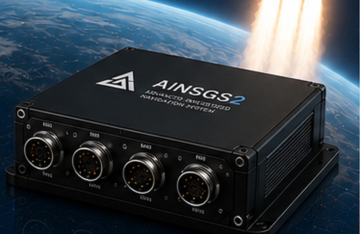
A high-precision inertial-satellite navigation system for autonomous, transport, aviation, marine and special platforms.
Purpose
AINSGS2 combines synchronized IMUs, GNSS, barometer, magnetometer, EKF filtering, service telemetry and a web interface. The system remains operational under vibration, high dynamic loads and temporary GNSS loss.
Key advantages
8 synchronized IMUs improve motion estimation and reduce the effect of individual channel failures.
EKF filtering, Dead Reckoning and modern GNSS support for stable navigation.
INS update rate up to 1000 Hz for dynamic platforms, autopilots and control loops.
Ethernet, CAN FD, UART, SPI, I2C and PPS for system integration.
Configuration, diagnostics, calibration and parameter control through Web UI.
Safe Save on power loss, state control and protection of critical settings.
Applications
 UAV and UAS
 Ground platforms
 Surface vessels
 Submersibles
 Autonomous platforms
 Mobile mapping
 Civil aviation
 Military aviation
Technical specifications
| Processor | STM32H755ZI, Cortex-M7 + Cortex-M4 |
|---|---|
| IMU | 8 x TDK ICM-45686, 6-axis |
| Accelerometer | ±2 g ... ±32 g |
| Gyroscope | up to ±4000 °/s |
| INS rate | up to 1000 Hz |
| GNSS | u-blox M10, GPS/Galileo/BeiDou/GLONASS/QZSS/SBAS |
| Sensors | RM3100 magnetometer, SPL06-001 barometer |
| Interfaces | Ethernet, CAN FD, UART, SPI, I2C, PPS |
| Power | 9-36 V DC |
| Temperature | -40 ... +85 °C |
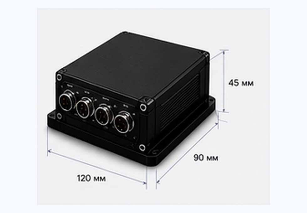
| Size | 120 x 90 x 45 mm, mass up to 450 g |
Comparison
| System | Class | IMU | INS rate, Hz | Navigation during GNSS loss |
|---|---|---|---|---|
| Pixhawk Cube Orange | AHRS/GNSS | 1 | 400 | up to 10-30 s |
| VectorNav VN-100 | Tactical AHRS | 1 | 1000 | up to 1-5 min |
| VectorNav VN-300 | INS/GNSS | 1 | 1000 | up to 30 min |
| SBG Ellipse-N | INS/GNSS | 2-4 | 200 | up to 60 min* |
| Advanced Navigation Spatial | INS/GNSS | 2-4 | 200 | up to 60 min* |
| AINSGS2 | INS/GNSS | 8 | 1000 | up to 2 h+ |
* Values depend on operating conditions and system configuration.
Interfaces
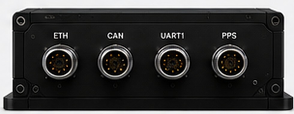
Web UI, API, firmware update and fast service access.
Data exchange with autopilot, controller or vehicle system.
GNSS MSP, service telemetry and integration channels.
Synchronization of sensors, external systems and timestamps.
Reliability
AINSGS2 is built for systems where data stability, state control and predictable integration are critical. Special versions can be configured for high loads, high-altitude use and autonomous navigation.
Contacts
Describe the carrier, interfaces, data rate, operating environment and navigation requirements.